
Well we have officially entered the dog days of August - the teeth of our summer. The end of this week and into at least the first part of next week will be the hottest period so far this year as an area of high pressure has parked itself right over Texas. In fact yesterday was the first time this year that the official temperature at Bush Airport (the official recording station for Houston) reached 100 degrees, a mark that could easily be reached a couple of more times over the next week or so.
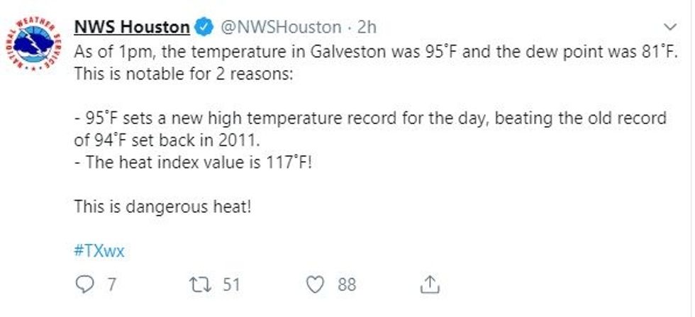
As we know down here, while the temperatures are hot, it is the humidity that is the real monster, and there will be no shortage of that either. The humidity provides a double kick to the face in these situations since it 1. causes the heat index to soar and 2. prevents the air from cooling down much at night after the sun goes down because moist air takes a lot longer to cool down than dry air. This was evidenced by the fact that early the past couple of mornings, when the temperature should be the lowest, Galveston was recording a heat index of almost 100 degrees because the humidity was absurdly high. Speaking of absurdity look at this tweet from the National Weather Service Yesterday afternoon:
 WUT?!?Twitter NWS Houston
Yes that really says the heat index or "feels like" temperature was 117 degrees at 1 pm yesterday afternoon. The dew point of 81 degrees indicates incredibly humid air on top of temperatures in the mid 90s. Any other time of year a dew point of 81 degrees would be like rocket fuel for thunderstorms, but that area of high pressure I mentioned is keeping a lid on things.
That high pressure, which is an area of sinking air, has anchored itself over Texas and will make our great state the heat bulls-eye for about the next week. So why does high pressure make things so hot? As air sinks from the lower pressure areas of the atmosphere towards the surface it heats up due to friction among air molecules, additionally the sinking air cuts off any lift that would be necessary for rain or cloud cover so we are left with clear skies and abundant summer sunshine. You can really see the effects of this area of high pressure in the two images below. The first is temperatures, the second shows how Texas is basically in a big donut hole when it comes to rain through next week.
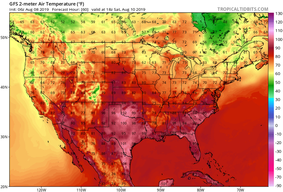 Forecast temperatures Saturday afternoon. Heat is centered right over TexasTropicaltidbits.com
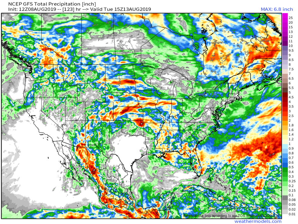 Forecast rain amounts thru Tuesday. Most of Texas is bone dryWeathermodels.com
So is there any relief in sight? This "heat dome" wont last forever, but we still have about a month or so of peak summer left. Next time I will share a bit more on what the average dates are of when things start to cool down, so stay tuned.
Finally, a brief word about the tropics:
Dead.
See I told you it would be a brief word.
Most Popular
Listen Live
