
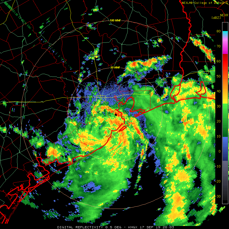
Well since this morning our tropical blob grew up into Tropical Storm Imelda, which lasted all of about an hour over the water before moving inland near Freeport. Right now the center of the storm is in Brazoria county, moving generally northward into Harris county.
 College of DuPage
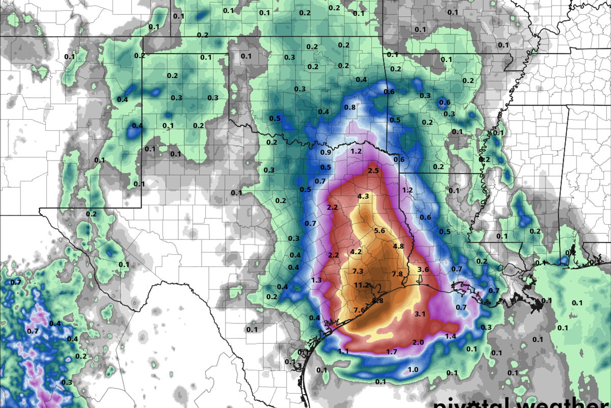
Rain bands will continue to move in over the area for the next few hours further saturating the grounds. Given the storm's position and speed I am becoming a little more wary of what is called a "core rain event." I mentioned this in my post this morning and it is basically where heavy rain consolidates around the center of a tropical low after sunset, and right now the center looks to move directly over Houston this evening. While I am NOT saying the entire city will see flooding tonight, I think that at the very least some street flooding is looking increasingly likely tonight into the wee hours of tomorrow morning. The models have held firm on 8-10 inch rainfall amounts around Houston and east towards Beaumont between now and Thursday evening but are still dropping 15-20 inch bombs on isolated areas. I feel like a broken record saying this now, but we just can't tell you exactly where those isolated spots will be. My best guess is somewhere near I-10 plus or minus a few miles to the north or south between Katy and Beaumont.
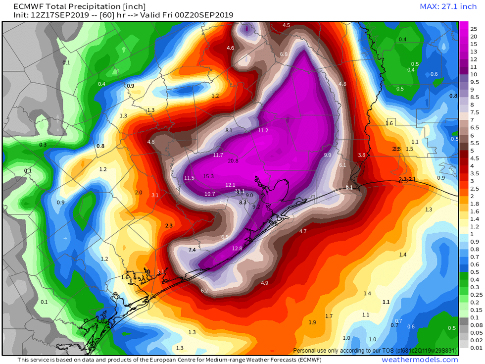 European model for total rain through Thursday afternoon.
I struggled with whether to include the above computer model image but I decided it was worth it to show the potential area of concern and also to show how sharp the gradient will be between a good lawn watering and something more disruptive.
As I said this morning, any one spot in the area has a relatively low chance of seeing those 15-20 inch amounts, however no spot as a 0% chance. I know it is frustrating to not have definitive answers but these systems are notoriously difficult to forecast when it comes to pin pointing bulls eyes.
As the center of circulation drifts north of town I believe we will see a bit of a break tomorrow morning into tomorrow afternoon. After that models are showing another band of heavy rain developing across the area later on Wednesday, but let's get through tonight before getting into that.
You can find me on Twitter @stephenuzick
Most Popular
Listen Live
